As is the case with most of the world’s populous estuaries, much of Humboldt Bay’s shoreline has been completely redesigned. Its once extensive salt marshes were long ago diked and drained; its edges since refashioned with varied technologies to stem the shifting forces of powerful tides. Seventy five percent of the bay’s more than one hundred miles of shoreline is now artificial, and ten percent of the bay’s nearly nine thousand original acres of marshland remains. Earthen dikes were some of the shoreline’s earliest refashioning agents—built from the bay’s own mud in the late 19th and early 20th centuries to create the vast tracts of agricultural land that are still actively used. A girdle of railroad grade that once served numerous lumber mills still encircles much of the bay and forms a largely ocean-proof barrier, as do sections of roadbed along Highways 101 and 255. Rock and concrete revetment (as well as various types of bulwark) lines many sections of shoreline as well—particularly near urban and industrial zones, as well as along the bay’s main ship channel and harbor entrance. Segments of natural shoreline can still be found too—particularly along the bay’s southernmost spans and the South Spit’s eastern edge.
Though this currently configured shoreline has spent more than a century reliably maintaining the bay’s assigned footprint, this boundary is slated for significant changes in the near future. Relative sea level rise is more rapid here than elsewhere along the west coast because tectonic forces are slowly pushing the shoreline downward while the ocean continues to rise. This rise, for example, is currently clocked at 4.7 millimeters per year at the bay’s entrance tide gauge, and has been predicted to advance at least 39 inches by 2100. In a relatively short time, Humboldt Bay will recoup its far larger historical footprint, with seawater potentially inundating everything since built into this space—including homes, businesses, and farms, as well as critical transportation, power, water, and telecommunications infrastructure. Episodic and dramatic King Tides (extremely high tides caused by astronomical and weather events) are already threatening many sections of shoreline, and now demonstrate what average tides will look like well within our own century. Mapping and assessing the shoreline’s myriad characteristics and vulnerabilities—along with developing regional adaptation strategies—are essential first steps, and this work is now underway. Coordinating the efforts of individual landowners and the mosaic of jurisdictional units that govern this sprawling intertidal zone is another crucial step, as will finding the funding for shoreline reinforcement that can cost upwards of two million dollars a mile. Competing for funding with far larger entities (like the ports of Oakland or Los Angeles/Long Beach) is a challenging endeavor as well, as will determining when, where, and what to preserve or eventually relinquish to the forces of the mighty Pacific.Shoreline abatement is also complicated by the lingering residuum of Humboldt Bay’s more than 150 years of intensive industrial activity. Along with the toxics commonly found at postindustrial sites elsewhere around the world (including heavy metals, PCBs, and petroleum products) this bay’s particular problem includes the chemical Pentachlorophenol, a dioxin-laced wood preservative used extensively in the mills and spilled onto the mudflats for decades until its eventual ban in 1985. Repairing these hot spots is still an expensive work in progress, and involves excavating and trucking tons of contaminated tidal mud to disposal sites as far away as Utah. The arguably hottest spot of them all was disastrously sited on the sacred island of the Wiyot people in the center of Humboldt Bay, but this decades-long cleanup has been recently and very successfully completed. Pentachlorophenol contamination was also discovered (and subsequently removed) from the former Simpson plywood mill site at the foot of Eureka’s Del Norte Street—a site that is particularly ill suited for toxins on account of its proximity to the bay’s only public fishing pier. Another recent remediation project includes the former G&R Metals site on the Eureka waterfront between G and I streets, where polychlorinated biphenyls (PCBs), heavy metals, and other contaminants were removed to make way for future shoreline development and the extension of the city’s new waterfront trail. Contamination sites still awaiting attention include the notorious and artistically embellished former Holmes/Eureka mill site (Parcel 4) behind the Bayshore Mall, as well as Eureka’s 38-acre Balloon Track—a derelict and controversial former train yard wedged between Broadway Street and Waterfront Drive.
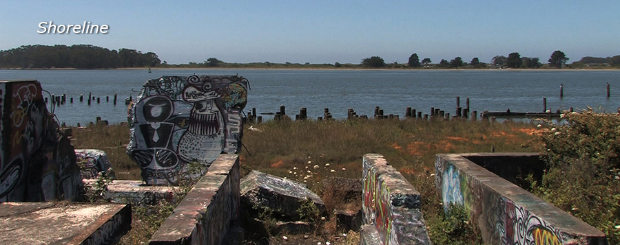
Shoreline restoration projects can be catalysts for community involvement—Eureka’s new Hikshari’ Trail system and the Wiyot’s Indian Island cleanup are especially notable examples. Many of these projects must navigate the ongoing challenge of the shoreline’s numerous clandestine residents, however, who find some measure of seclusion in the rambling stretches of riparian thicket and rubble. This population of people will certainly face continuous displacement as this region undergoes its gradual but inexorable postindustrial transformation. Other community members also regularly use unsanctioned sections of shoreline for subsistence foraging and fishing—populations of people who sometimes view this zone from perspectives more practical than picturesque. These people will continue to need safe and suitable access points to sustain their culture and livelihoods.
The bay's shoreline houses diverse points of contact for a similarly diverse bay community—points that create a terrestrial armature for interactivity, collaboration, and conflict. This vastly beautiful and critical boundary indexes some of this community’s most pressing problems and threats, but also affirms its agency as a powerful site for civic engagement.
